Mount Rundle Summit
Location
Banff National Park
Town of Banff
Difficulty
Hard
1750m Elevation Gain
Duration
8-10 Hours
16-17km


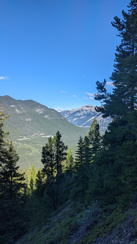
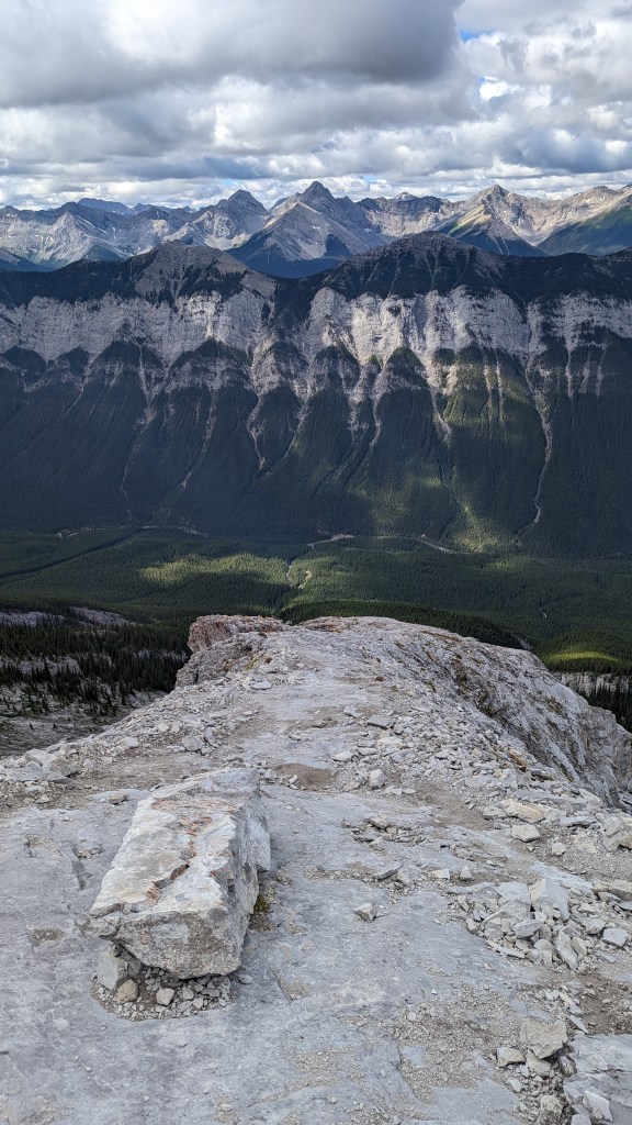
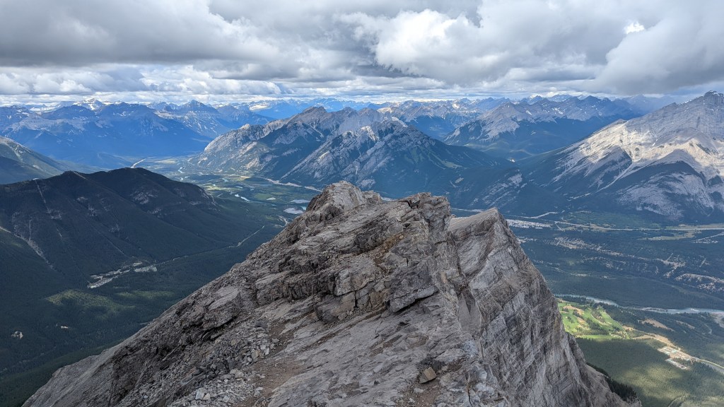
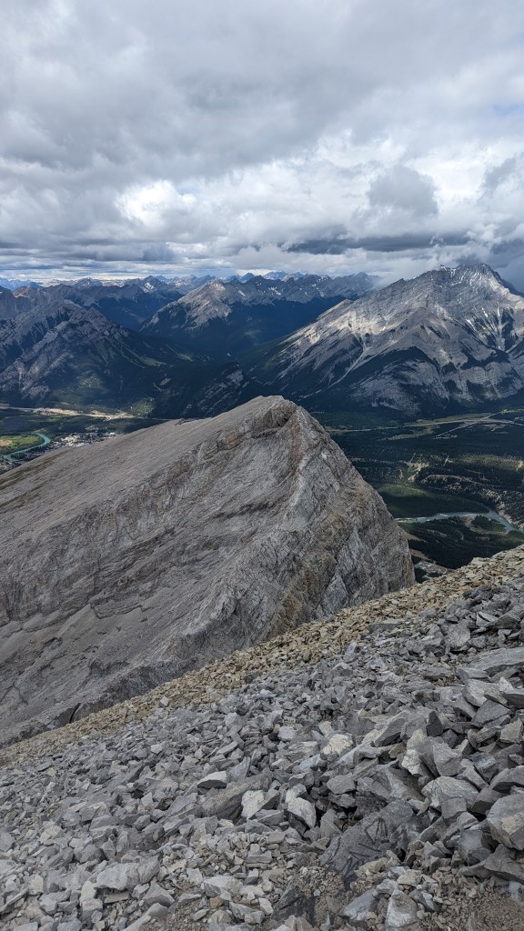
Mount Rundle is one of the iconic peaks dottingBanff’s skyline – its extraordinary sharp shape can be seen from all around town. In fact, its full entire seven peaks is in full display during the drive into the national park from the Alberta side. In this section, I’ll only be covering the most western peak – the peak seen from the town of Banff. The hike covering all 7 peaks is a whole different monster itself with the other end being by Canmore.
Recommendations
Make sure to use a hike app or map. It is quite easy to lose sight of the trail in the boulder field and in the dense forest especially as the path forks into other trails.
Wildlife: Did not see too many wildlife, other than the common birds and squirrels. However, moose, elk, deer, bears and more are known to be in the area of the national park.
Equipment: Hiking poles,


Cascade Mountain Summit
Location
Banff National Park
Town of Banff
Difficulty
Harder than Hard
1700m Elevation Gain
Duration
8-12 Hours
19-20km
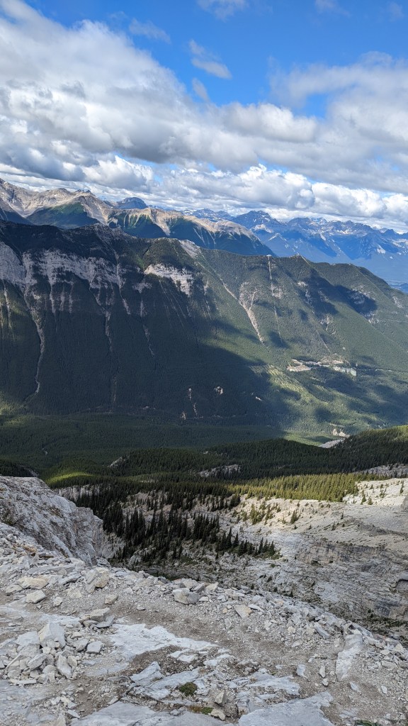
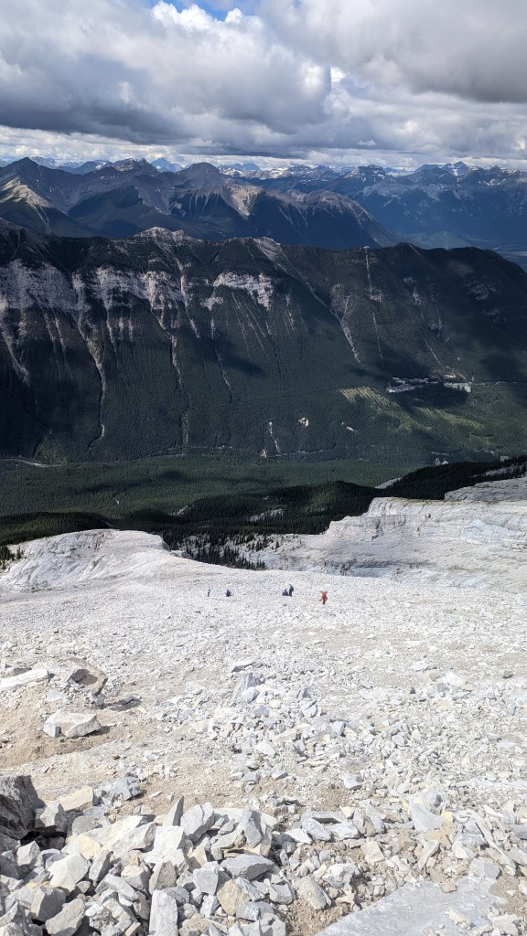
Cascade Mountain is another classic mountain surrounding the town of Banff – its peaks are iconic and are probably in the background of countless memories. Another summit, another memory. This time, I started out fairly early. The trail head starts at Mount Norquay parking lot where in the winter it is a ski hill. In the summer, it is where most of the hiking takes place and it is common to drive up or take the bus there. I started a little later than planned – around 7:00AM and finished later than planned as well – around 6pm. I was not feeling the best and was going through a slight food poisoning so take this hike review with a grain of salt. I also took several long breaks and naps on my climb up and down.
The hike from the trail head to the base of the mountain is fairly simple, well marked and straight forward. Surrounded by dense forests and greenery, it is hard to make out any views of the mountains at all. As you pass a number of streams and rivers, eventually the steepness starts picking up and the road forks. On one side, the trail continues deeper into the valley where it reaches the end of a different hike: Cascade Amphitheatre. It is important you follow the other trail as it eventually will lead to the summit.
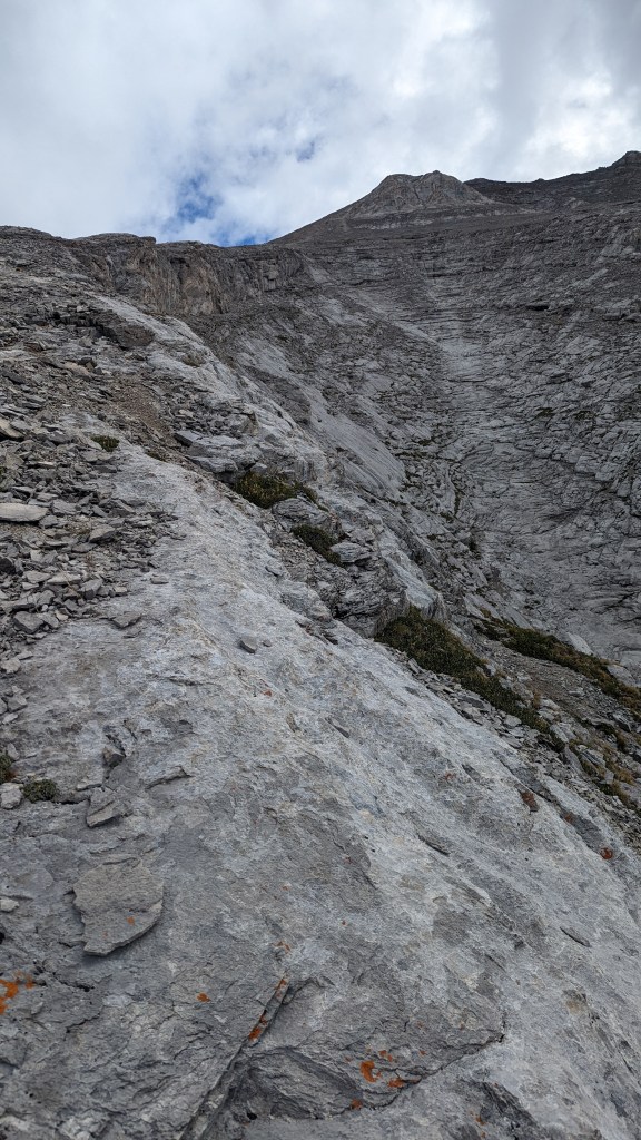
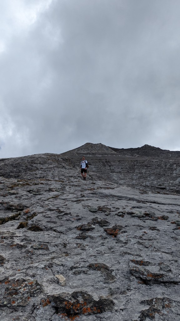
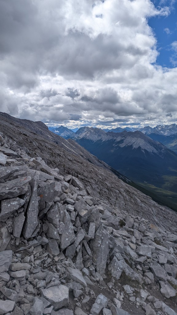
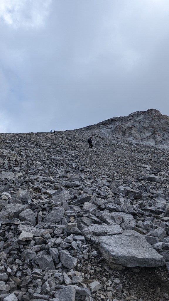
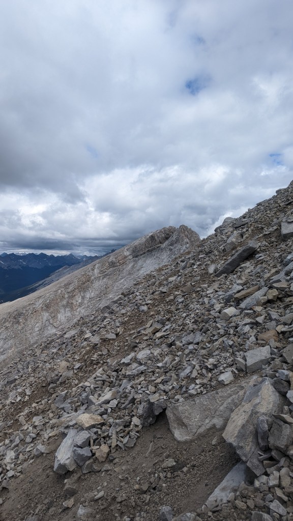
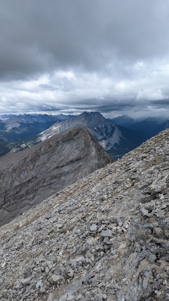
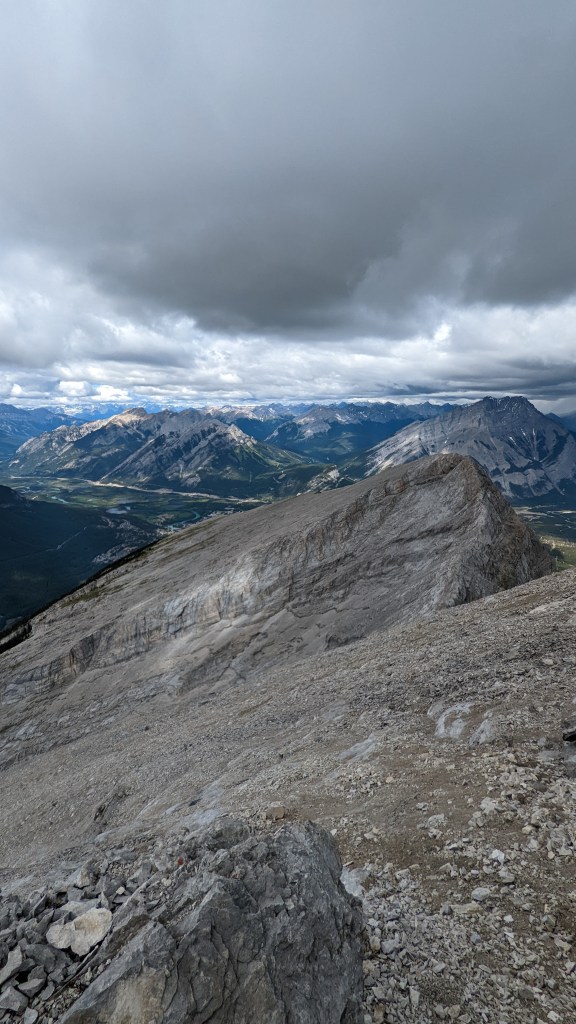
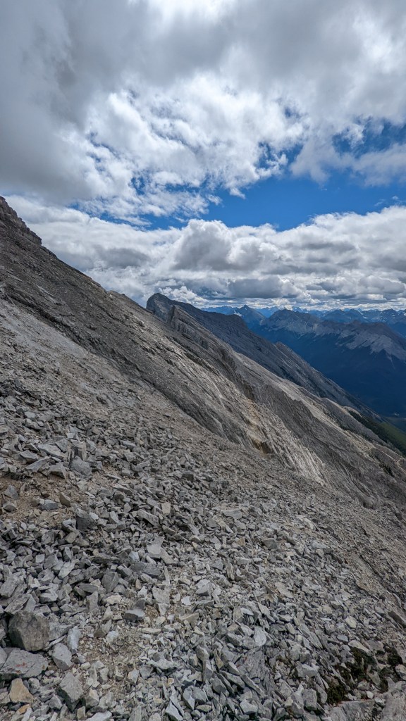
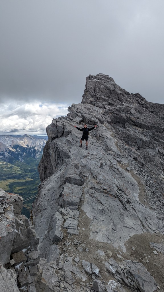
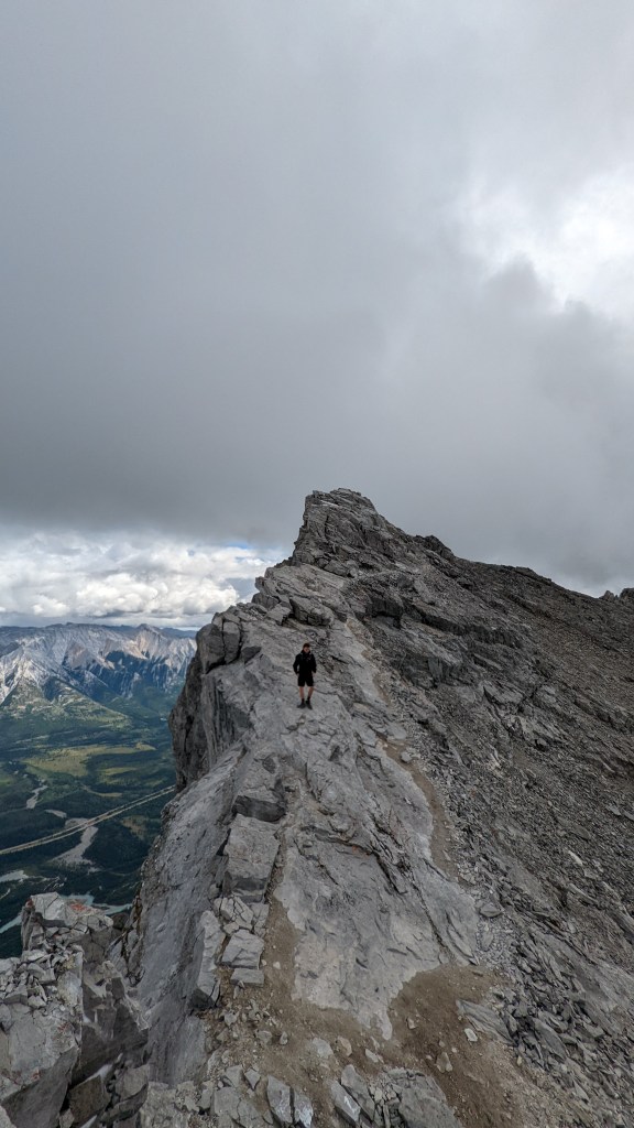
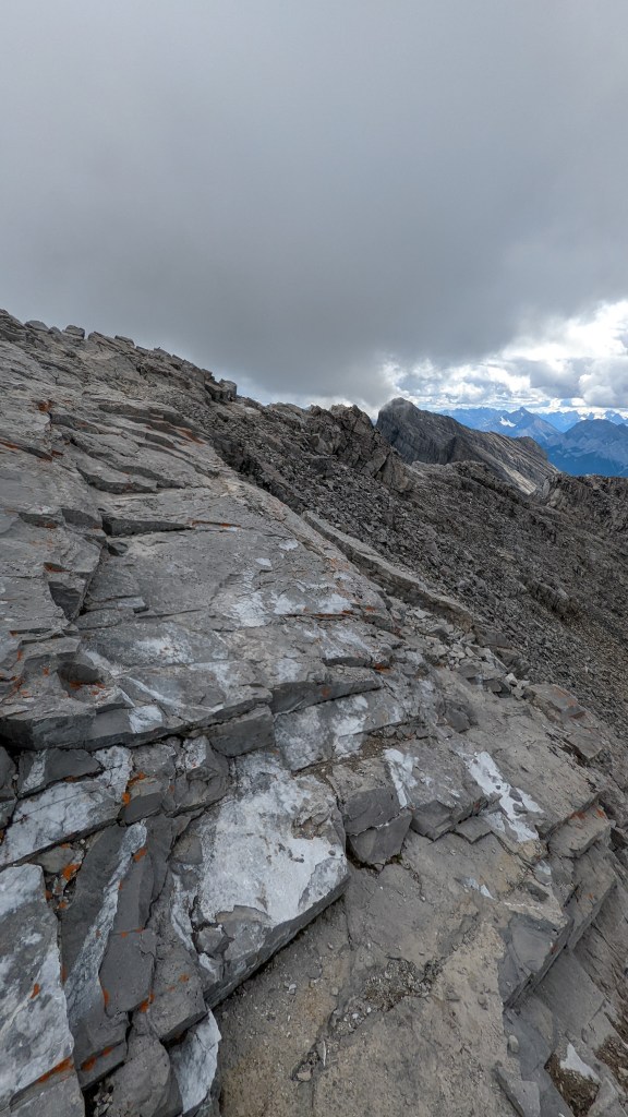
The path gets a lot steeper and eventually, the tree cover completely disappears and the views of the valley and the goal shows up. At this point, the trail also turns rocky, and is still well marked though not as obvious as before. The trail marks varies – from colorful flags on trees or branches, to painted rocks or tall cairns. Be mindful to closely follow these as it is easy to lose the trail – especially since the traverse turns into a boulder field. Personally, on the way down I had lost track of the path and gotten lost in this boulder field. I had to back track a fair ways up and waste some of my energy and time.
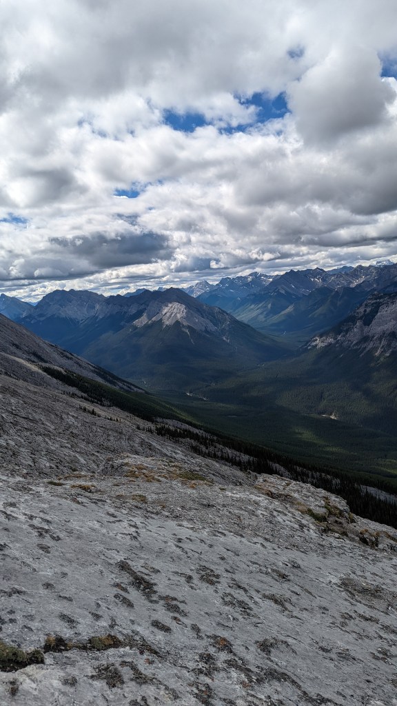
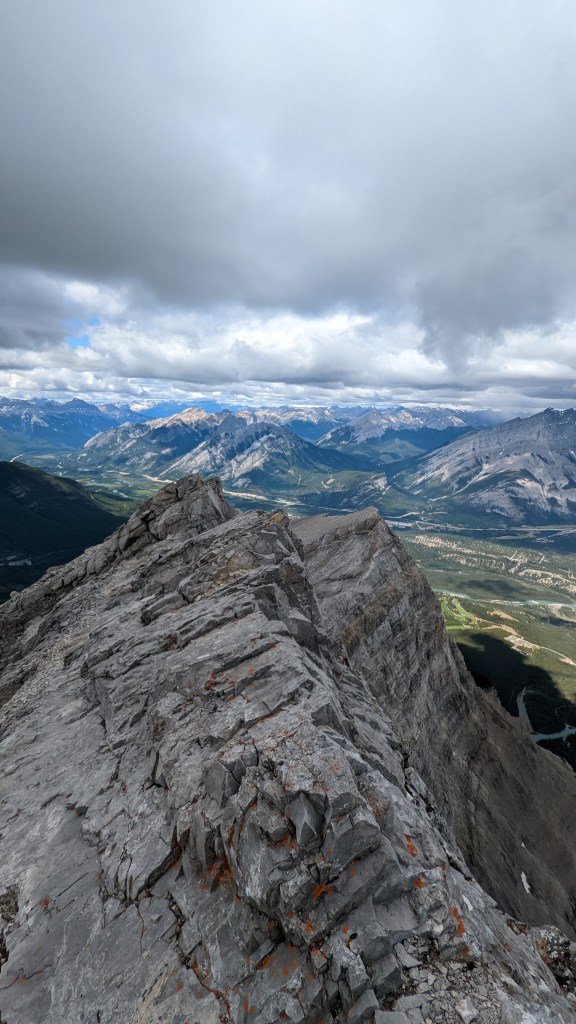
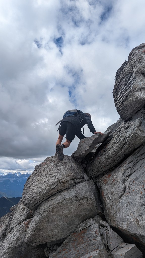
The views are unreal and as the hike progresses even further, some of the town of Banff and the amphitheater slowly comes into view. At this point, it is a hard and strenuous hike up to the mountain with astonishing views of the Rockies. The last kilometer before the summit push is a grueling scree with a small amount of scrambling at the top.
Recommendations
Make sure to use a hike app or map. It is quite easy to lose sight of the trail in the boulder field and in the dense forest especially as the path forks into other trails.
Wildlife: Did not see too many wildlife, other than the common birds and squirrels. However, Moose, Elk, deer, bears and more are known to be in the area of the national park.
Equipment: Hiking poles, proper foot gear, a head light for the dark when starting early/ending late, plenty of food and water.
19-20km, Out and Back – 1700m Elevation Gain
Photos From the Trail
Sulphur Mountain to Gondola
Location
Banff National Park
Town of Banff
Difficulty
Moderate
800m Elevation Gain
Duration
2-4 Hours
6-12 km
Sulphur mountain is one of the nearby mountain peaks in the town of Banff. Compared to its surrounding colleagues, this mountain is a lot shorter and smaller. However, there is a great pull towards this peak. First, it is one of the peaks; that in itself is enough to attract visitors and hikers alike. Second, the Sulphur Gondola is situated here and is an easy way for non-hikers to climb to the top; it goes without saying that this is one of the town’s main attractions. There is a great lodge at the top with a restaurant, cafe, and entertainment. Don’t get me started on the views.
To get up this mountain, many take the gondola. However, the price is a bit of a turn-off and there is a second way. This is the Sulphur Mountain hike. It starts at the parking lot of at the base and at the trailhead, it is a consistently uphill battle. It is not an overtly technical hike – the trail follows a well marked, well used dirt path all the way to the top. I did this hike in the winter in the late afternoon to catch the sunset. I don’t think there is any trail maintenance in the winter so be aware.
The views itself was fantastic. The trail starts at the base of the mountain covered by lush forests. There is no views at first but around halfway, the trees start to thin out. As the foliage opens up more, the view of Mount Rundle’s peaks and its back-side valley start to dominate the views. The trail is a seemingly never-ending switchbacks all the way to the top as you eventually follow the gondola trail. Unfortunately, the views doesn’t really change much until you get to the summit.
Fortunately, I was able to take the gondola down back into the parking lot. There are conflicting reports whether the gondola down is free or not. I have heard both sides and I am leaning towards that yes, it is free to go down. However, I can also see the possibility of a charge during the peak summer tourist season. Do your own research as this can affect your hiking plans.
Recommendations
Use of a map or an app is recommended but I would not worry about getting lost. It is well marked, very popular, and close to civilization.
Wildlife: Did not see too many wildlife, other than the common birds and squirrels. However, elk, deer, bears and more are known to be in the area of the national park.
Special Equipment: Hiking poles would be great.
Photos From the Trail
Tunnel Mountain
Location
Banff National Park
Town of Banff
Difficulty
Easy
270m Elevation Gain
Duration
0.5-2 Hours
4-5km
Joining the mountain giants around the town of Banff, is Tunnel Mountain – AKA the sleeping bison. Its shape and location is an iconic part of the town. It is easily accessible in town and always a walking distance away.
The trailhead can be accessed from many different parts of town but it truly starts at the road that goes around the mountain. I wouldn’t even call it a mountain – it is more of a hump of dirt, rock and trees really. However, this measly hump of dirt and rock is an iconic and historic part of the town. It offers great views of the surrounding area and beautiful views of the mountains.
The hike itself is easy – truth be told, finding parking at the trail head is the hardest part. It is very unofficial and there is very little space. I would highly recommend parking in town and walking to the trailhead. This adds another 10 minutes to the hike but I’m sure it is worth it for the views.
The hike is consistently uphill – especially the first parts. These parts are on a fairly steep dusty dirt trail. It eventually peters our to flatter sections with beautiful views of the surrounding magnificence. Many use this hike as a daily walking trail, it can get fairly crowded and busy. It is simply an easy hike that has a great reward. I would highly recommend climbing Tunnel Mountain as a great introduction to the town.
Recommendations
On a nice summer day, It is a great spot for a picnic. There are plenty of flat areas at the top.
Wildlife: Did not see too many wildlife, other than the common birds. However, Moose, Elk, deer, bears and more are known to be in the area of the national park.
Photos From the Trail
Corey Pass Loop + Mount Edith (2 summits)
Location
Banff National Park
Corey Pass Loop Trailhead
Difficulty
Hard
1400m Elevation Gain
Duration
6-10 hours
14km
Corey Pass Loop and the summits of Mount Edith is a great and fun trail for adventurous hikers. The views are breathtaking, the terrain are varied and the trail is relatively well marked and well used. Here you will experience some pretty challenging scrambling with some exposure. Mount Edith has three different “summits” and we only did the first two as the last one has got some seriously dangerous sections. The two summits are fun yet still challenging.
We did this hike in the peak of the fall season and it was absolutely gorgeous. A grove of larch trees stands as the first taste by the trail head and it soon leads you to start climbing a fairly steep trail through a dense forest. Soon after, the trail becomes a steep ridge up towards the mountains where the view completely clears as you pass the tree line. Here is where the fun starts as you make your way to the pass. Corey Pass is an absolute stunner as it gives you an amazing view of the mountains behind the steep walls of the Mount Edith. Here you can detour to try and conquer the summits where some pretty good scrambling is involved.
Moving forward from the pass, the trail follows a consistent decline behind the mountain pass and into new territory. The environment and views here were absolutely jaw-dropping. Eventually, you will find yourself entering another dense forest as you lose the elevation gained. After a long walk, you will find yourself back at the trail head.
Recommendations
Make sure to use a hike app or map. It is quite easy to lose sight of the trail in the boulder field and in the dense forest especially at the second half of the Corey Pass loop. There are other trails that lead deeper into the back country and deeper into the forest. Make sure you bring a battery with you or an offline map to make sure you’re right on track.
Wildlife: Did not see too many wildlife, other than the common birds. However, Moose, Elk, deer, bears and more are known to be in the area of the national park.
Equipment: Hiking poles, plenty of water and food(we were running very low after a long day), some sun cover as the pass have very little shade, hiking shoes, and perhaps a helmet for some falling rocks at the summit sections.
